
On the history of Dry Brook
written by Bryan Quinn
Small streams like Dry Brook may seem minor on a map, but they are part of a much larger ecological system. Located in the small city of Beacon, New York, about 60 miles north of Manhattan, the Brook flows from the slopes of the Hudson Highland Mountains into the town’s main river, Fishkill Creek, and ultimately into the Hudson River Estuary. At its beginning, Dry Brook gathers from spring seeps and rainfall in the mountains before threading its way down steep slopes, wetlands, and development below. In spring it runs clear and lively, tumbling over stone shelves and plunging between boulders; in summer it narrows beneath a canopy of leaves so dense that at night moonlight cannot pass; after thunderstorms, hurricanes and nor’easters, it swells and moves with unstoppable force beyond the capacity of engineered flood control below. These rainfall events reshape its banks, creating opportunities for plants to find temporary habitat. Moss covers rocks, diseased hemlock trees fall and create new pools for salamanders, and ferns soften the banks. All just a few minutes’ walk from town. To stand beside the brook on a normal day is to feel how something modest can still be powerful, and, for the ecologically-minded, to wonder what its future will bring.
Watersheds are not passive landscapes but living systems whose inherent ecological energy continues beneath our streets and homes. Communities that recognize and design around this wildness build resilience, while those that suppress it inherit recurring problems.
For centuries, development in the Northeast has more often attempted to suppress this wildness than to live with it. Across the region—and worldwide—small tributaries have been redirected, buried, dammed, and reshaped to accommodate roads, railways, housing, and industry. The forests around them have changed just as dramatically. Most of the forests that look thickly wooded today were heavily logged in the eighteenth and nineteenth centuries for charcoal, farming, and industry—so heavily that many hillsides were nearly bare before the trees slowly returned. More often than not, what we see now in our woods is not untouched habitat, but a landscape that has partially healed, adapted, and grown back. While still wild and beautiful, they bear little resemblance to the forests that existed before colonial settlement. Gone are the massive hemlocks, the brook trout, the wolves, and the lush vegetative life that would have been typical of primary forest understory. Most importantly, the landscape is no longer shaped by the Indigenous land stewardship practices that sustained it for thousands of years—seasonal burning that renewed forests, careful use of wetlands, and settlement patterns that followed water rather than confined it. Those practices did not eliminate wildness; they worked within it.
This long history reminds us of something simple: every place carries its own narrative, and caring for land and water means listening closely to the specifics of that story. Understanding the location and dynamics of our often forgotten small streams—each one distinctive—helps explain why certain properties in our communities flood, where there are opportunities for restoration and development, and how we can restore their lost ecological functions.
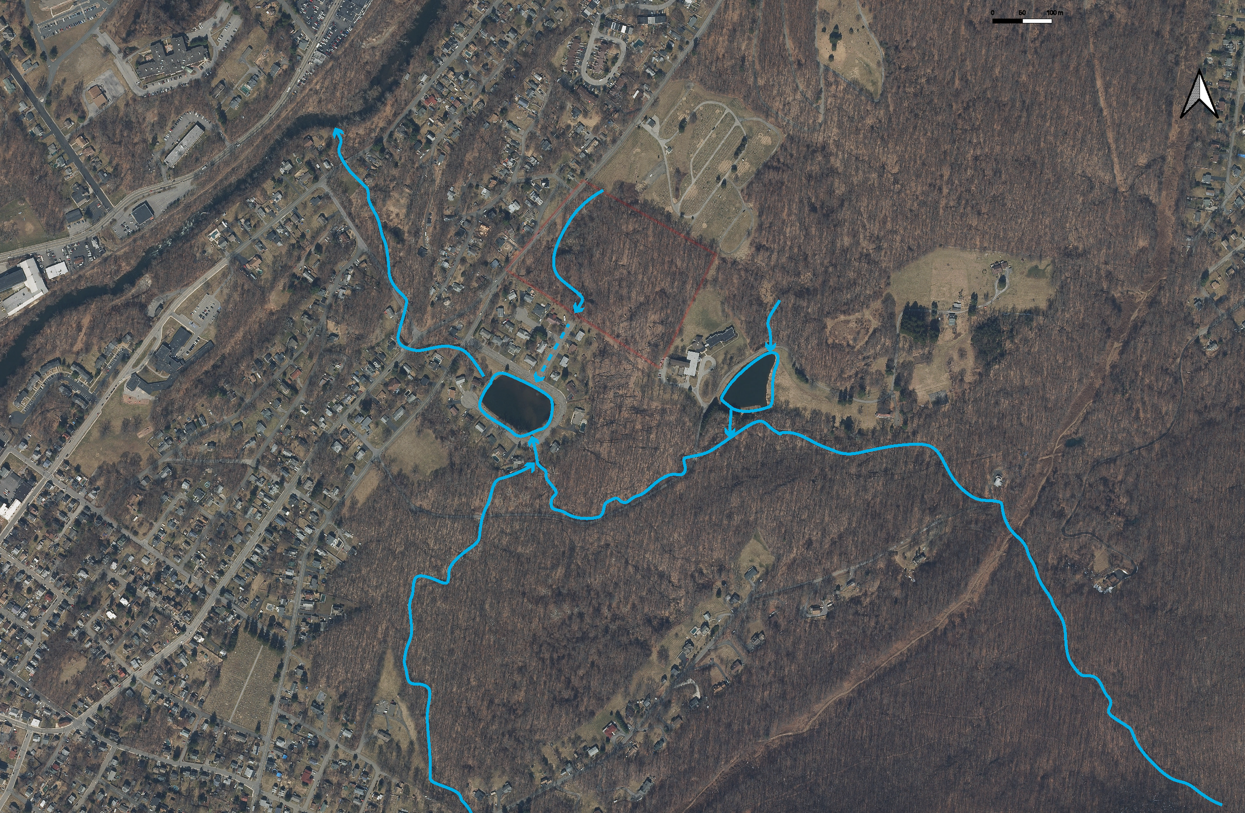
An illustration of the likely stream flow patterns in the lower Dry Brook watershed.
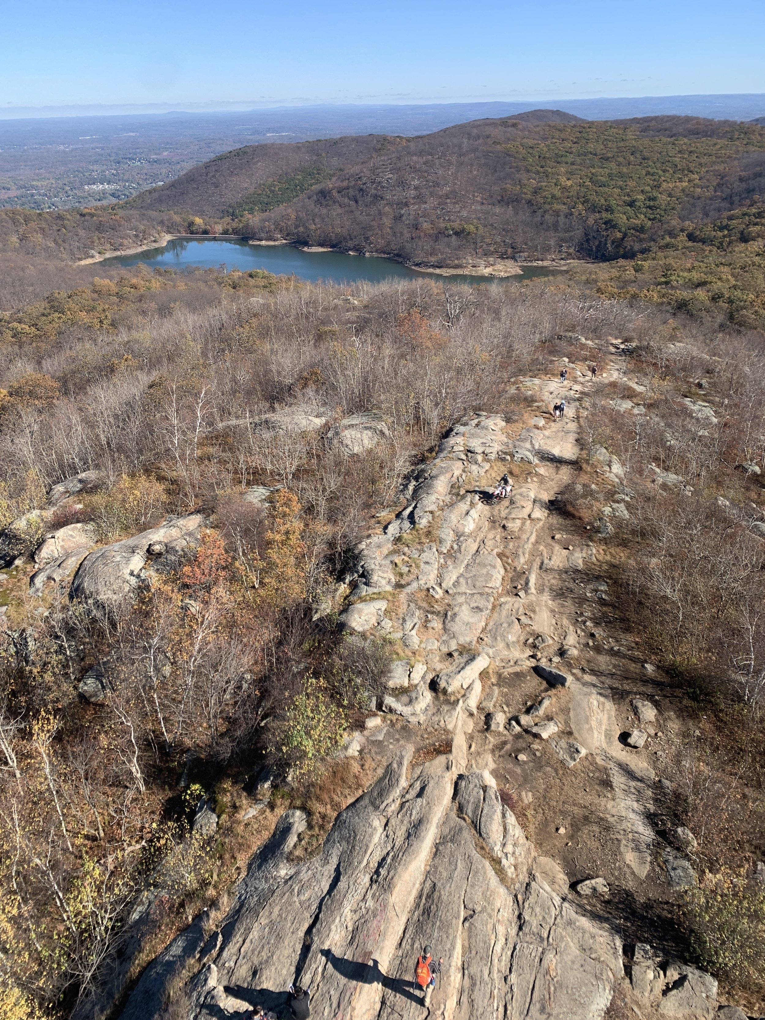
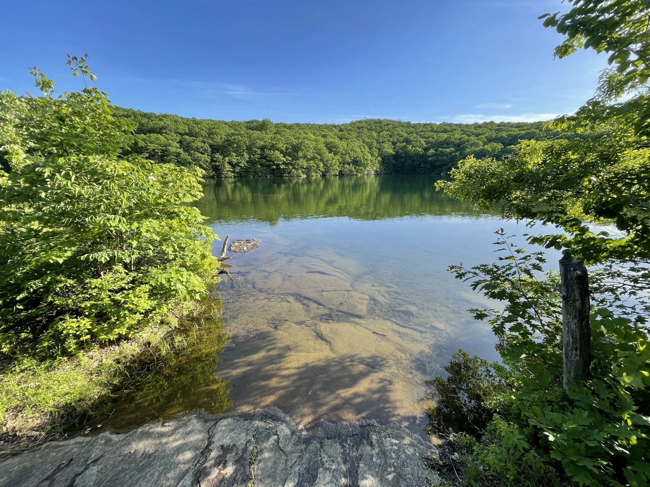
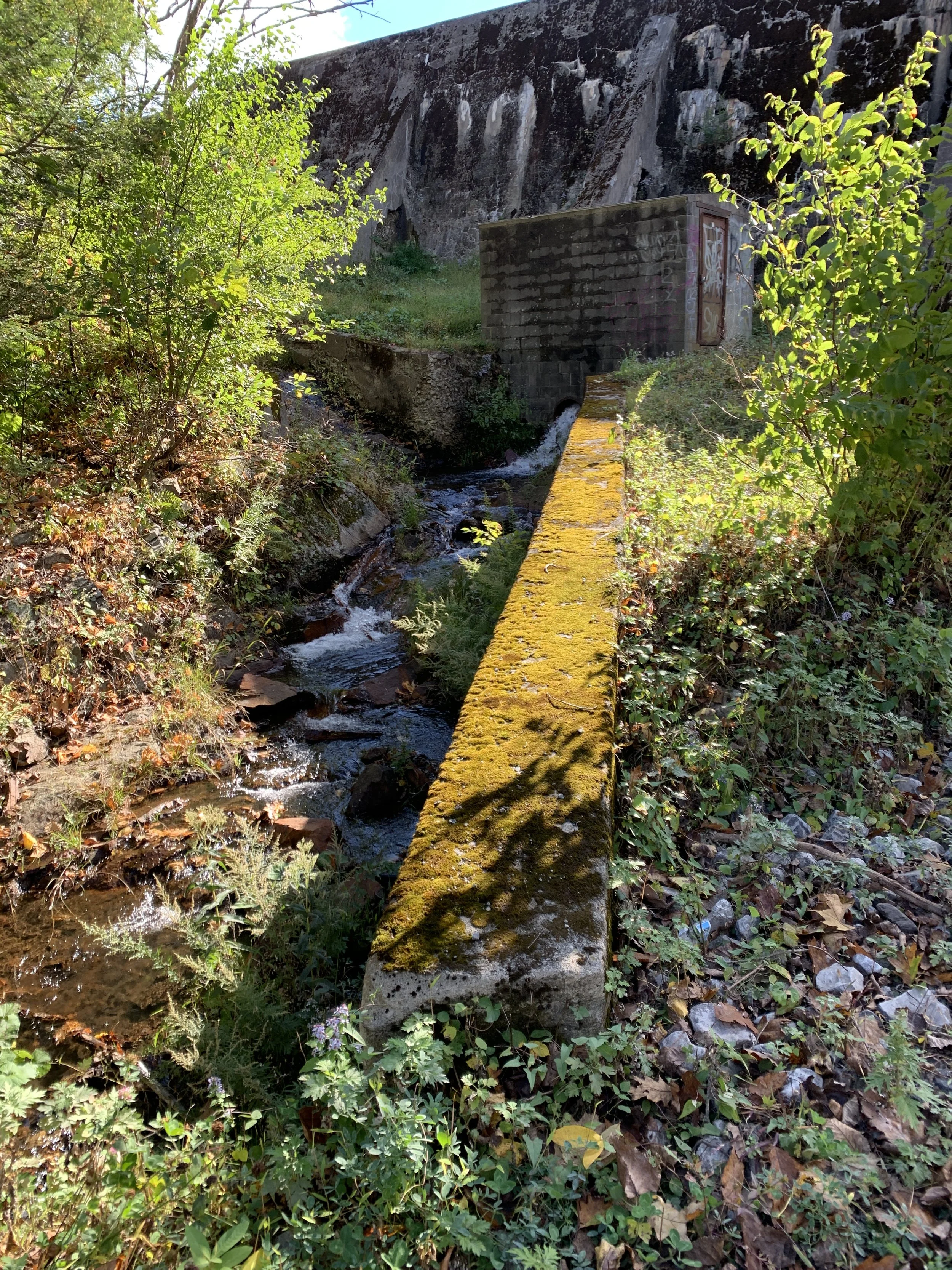
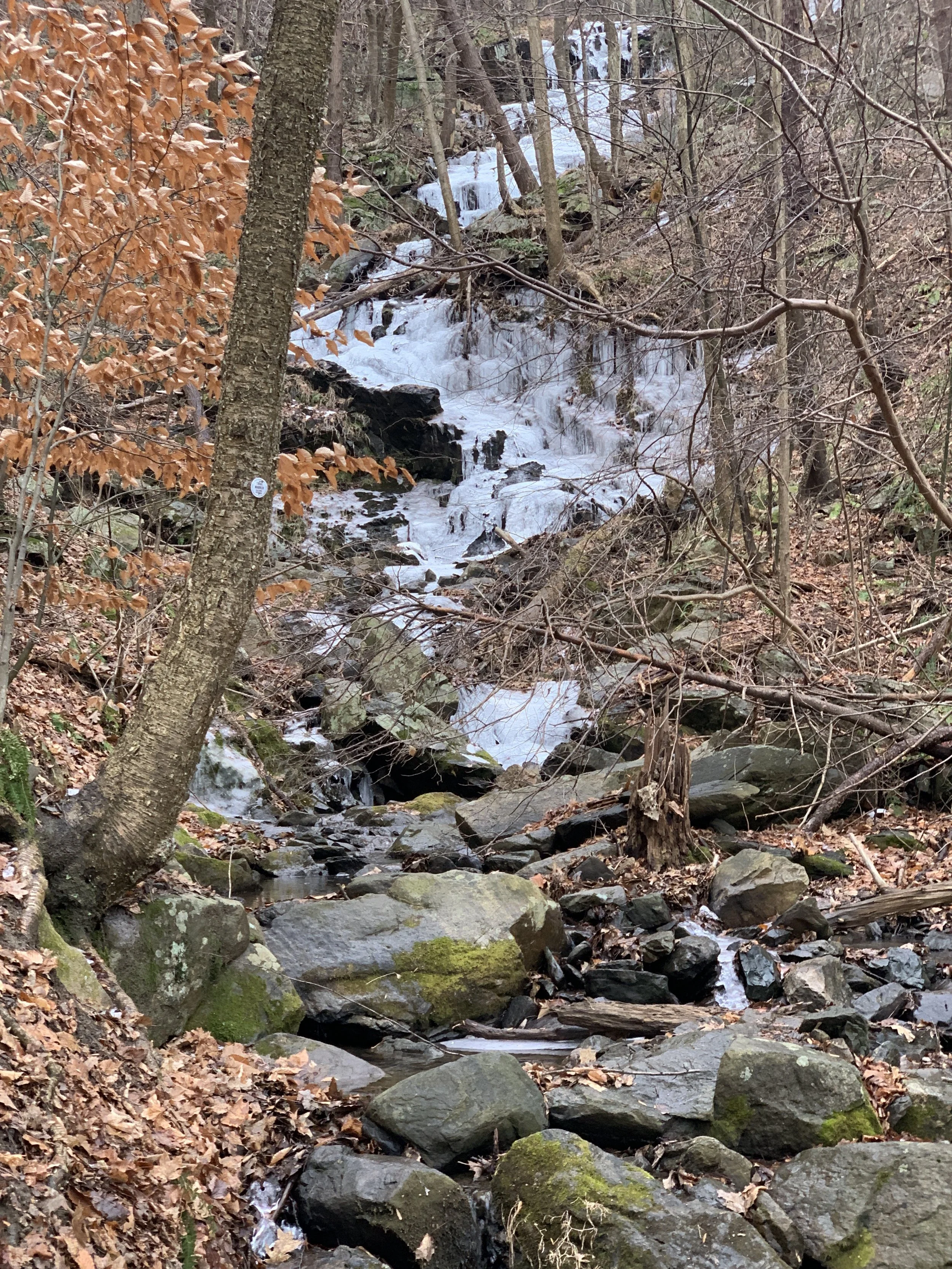
In its upper reaches, Dry Brook provides critical drinking water to one of Beacon’s reservoirs, which impounds the uppermost reaches with a fifty-foot tall concrete dam. It also intersects several well-traveled hiking trails, making it an important recreational resource for the community. The steepness of the terrain it travels along the northeast side of Mount Beacon, which towers 1,610 feet above the Hudson River Estuary, creates a dramatic series of waterfalls and pools that turn to ice walls in cold winters. For most of its length it moves through a shallow ravine where the air cools, sound deepens, and light narrows—the sound of moving water, humid summer shade, crystal clear pools between massive boulders, and the scent of wet carex and fern species in the spring. Like the circulatory system of our body, the brook heavily oxygenates in its upper reaches as it travels the forest lungs of the mountain.
Throughout the brook’s relatively small watershed, the wider ecology of the Hudson Highlands abounds: oak and hickory on sunlit ridges, rocky outcrops, and countless springs collectively following dendritic patterns that make up critical forest habitat. These forests shade the water and sustain birds, mammals, insects, and amphibians. In this setting, Dry Brook plays an essential role. It recharges groundwater and wetlands, hosts numerous amphibians, and generally gives form and ecological order for plants and animals to follow.
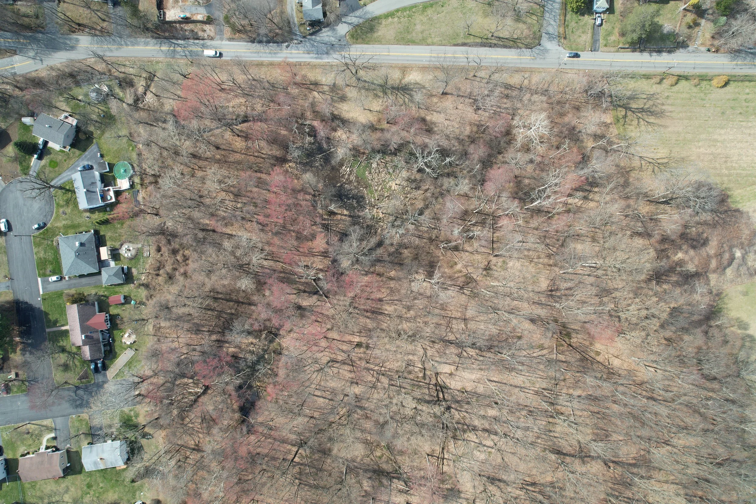
Yet the main channel tells only part of the story. The smaller tributaries that feed Dry Brook—seasonal streams, seeps, and unnamed swales in the uplands—are equally important. They gather rainfall, recharge groundwater, and determine how quickly water reaches the main stem. Much of the land now considered for development lies not along the brook itself, but in these upland areas and along its tributaries, where changes in grading, paving, and drainage quietly reshape the entire watershed downstream.
But that quiet wildness changes as the stream approaches town. The channel becomes more engineered as the result of development over the past several centuries. Culverts carry it under roads. Lawns replace forest. It runs beside poison ivy patches and under invasive Norway Maples in the beloved Hiddenbrooke Park. It receives water from roofs and pavement. Farther downstream it passes behind fences, collects road salt, backs up during high flows at engineered crossings and too-narrow channels. None of this is unusual for an urban stream. Across the Hudson Valley, waterways of all types have been asked to adjust to development, rather than the other way around.
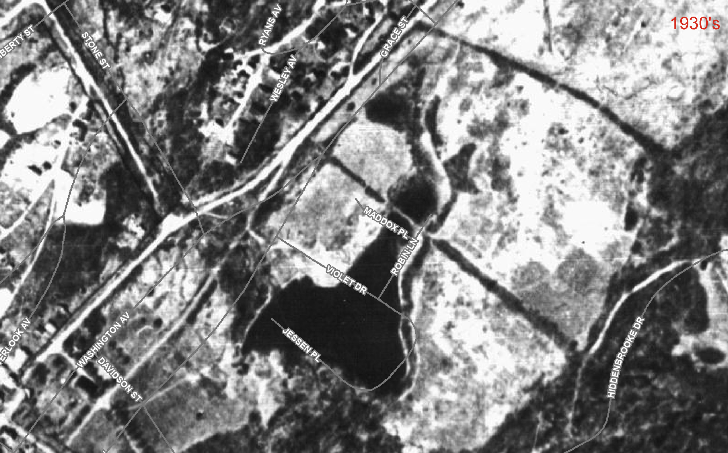
1930’s aerial imagery, pre-residential development with current roads as grey lines. The large black shape in the center is a pond.
In its most heavily modified reaches, older maps and aerial photographs suggest that the brook once widened into a meandering low wetland, possibly travelling subsurface to its confluence at Fishkill Creek during droughts. Some of those wetlands were later dredged to create small ponds, which show up in historic aerial photography from the 1930s. This is nothing unusual. For generations, wetlands like this were drained, filled, or reshaped to make land more developable or for industrial use. Over time, as the ponds lost their value to people, they filled with sediment and plant matter, slowly returning to their prior wetland state.
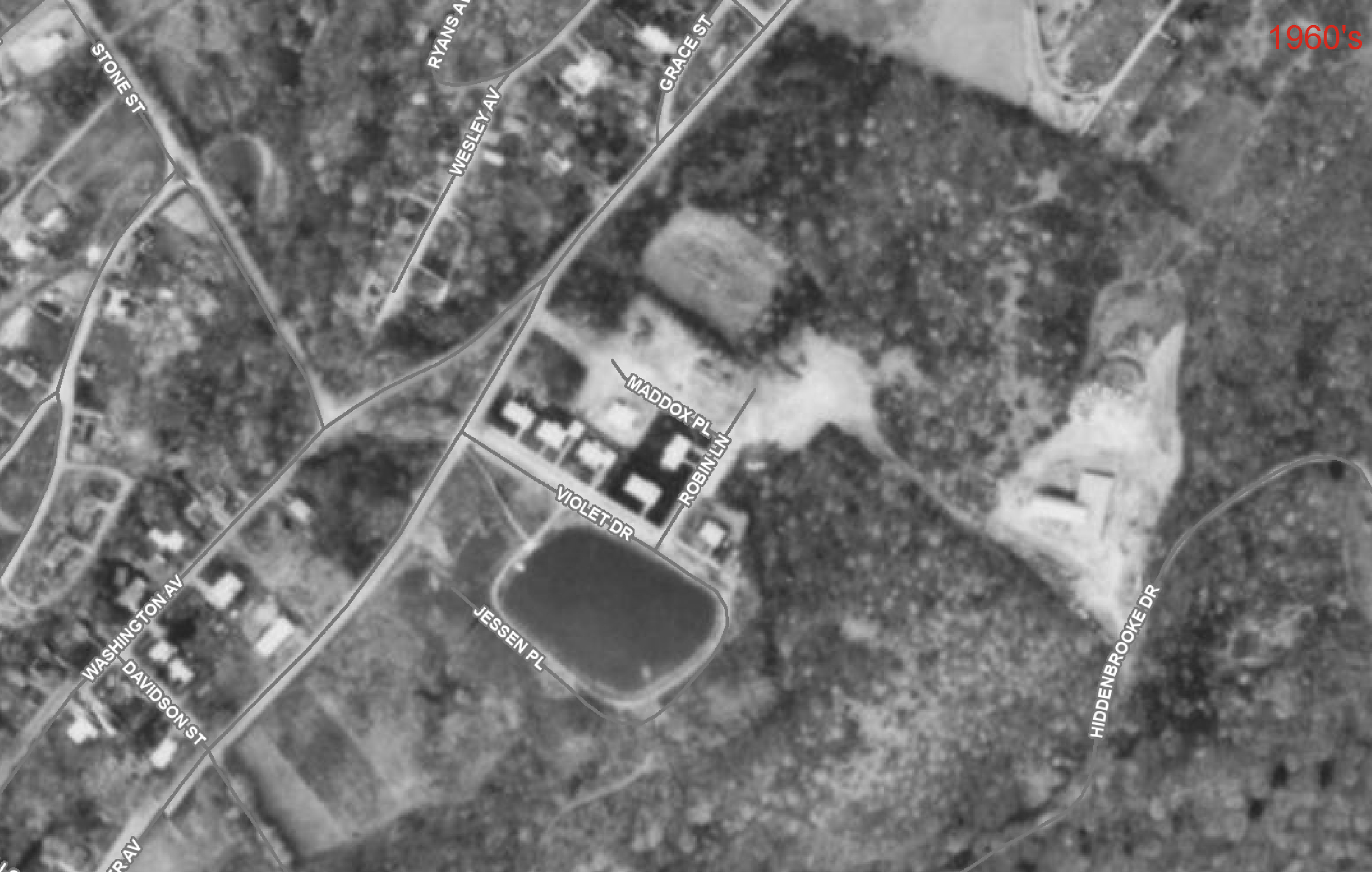
1960’s aerial imagery shows early residential development in the wetland and the beginning of the Carmelite Property development. The first of two new ponds is shown in the center of the image.
Dry Brook moves quickly down steep terrain, scouring its banks and carrying sediment downstream. Where the water slows, it drops that sediment, building the silts and clays that form wetlands. Like any river system, you will see large boulders, sand and stone in the steep areas and silt and clay in the flat reaches. Rivers and streams, especially ones on steep terrain, are difficult to control. Even when reshaped by human hands, they continue to adapt and change to do what it is their nature to do: erode, flood, deposit, and sometimes even dry up.
In the 1960s much of the brook’s lower wetland reaches were developed. A large Catholic Monastery—known locally as the Carmelite Property—and a series of residential blocks made two ponds and altered the stream flow in order to dry out land. The neighborhood gained streets and homes, but by the 1980s lost much of the floodplain’s ability to store and filter water. What wetlands once did gradually and invisibly, pipes now attempt to do quickly and mechanically. The result was a stream forced into a narrower, faster corridor. Decades later, that constraint shows up as clogged ponds, undersized crossings, and repeated flooding.
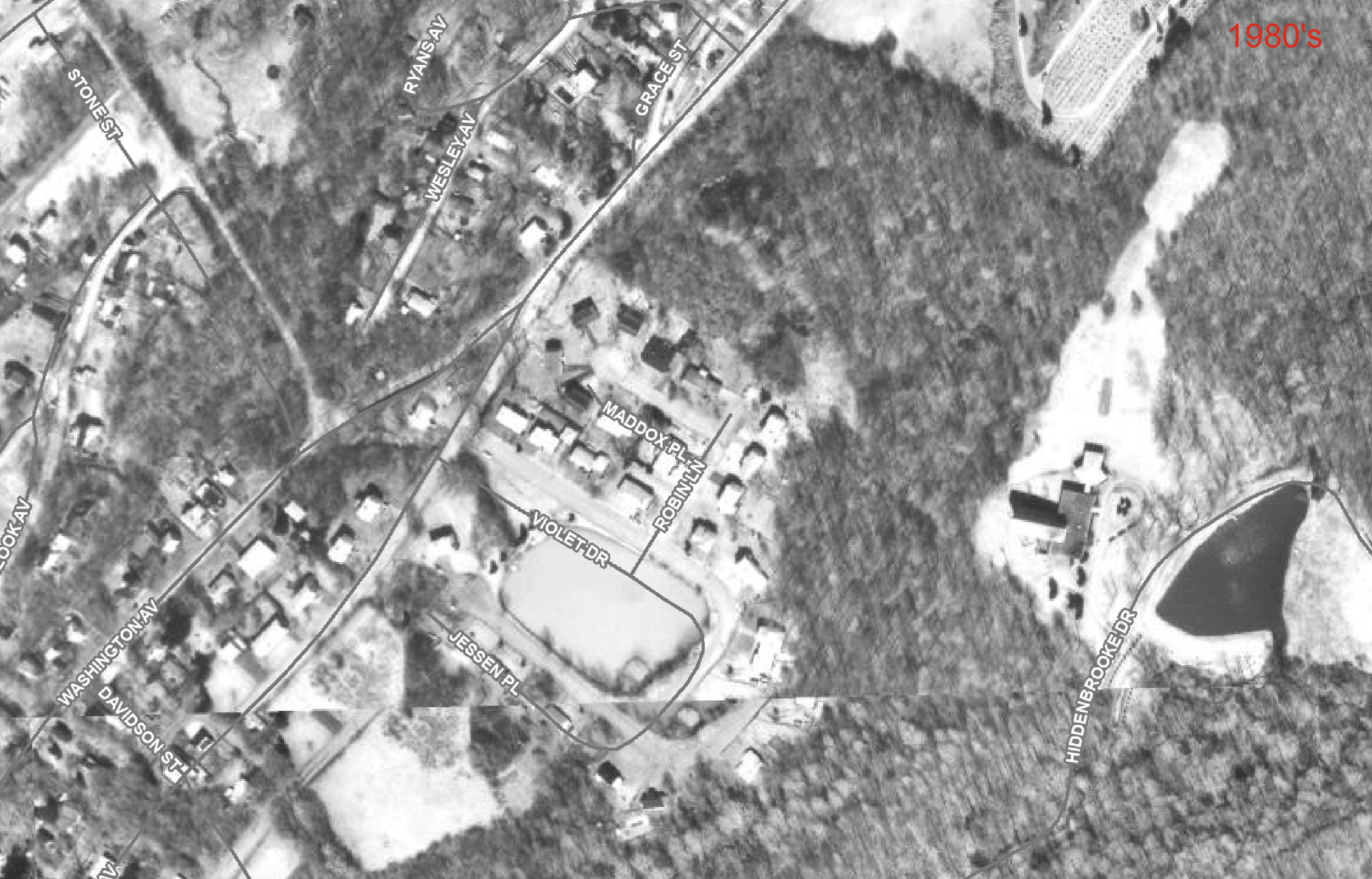
1980’s aerial imagery shows the residential development wetland infill and Carmelite property complete. Note the new pond on the right side of the image where there had previously been wetlands.
Parallel to that development, in disregarded ditches, wooded margins, shallow depressions—vegetation has returned and seasonal pools form each spring. Frogs call at dusk. Salamanders lay eggs in temporary, fish-free water. These small wetlands may not appear on maps, but they matter. They remind us that nature persists wherever it is given space.
Flooding in the surrounding neighborhood follows the same entropic story. Infrastructure that functioned when first installed now strains against the land’s older hydrology. Homes sit on land that once stored water naturally, and their basements flood. Ponds become shallower and shallower through deposition. During heavy storms, which have become more extreme in the past decades due to climate change, water has nowhere to go and rises quickly, surging through its channel and spilling into low areas. The contrast can be startling—a quiet stream one day, a forceful current the next because even small brooks need room to breathe.
The remaining open land along the brook offers a chance for better planning. New buildings can be placed on higher ground, leaving low areas as buffers and open space. Or not built at all. The existing ponds could be reshaped with planted wetlands to slow and clean water. Rain gardens, permeable driveways, restored swales, and daylit tributaries could reduce runoff before it reaches the brook. These may seem dramatic. But compared to the historic reshaping of the floodplain, they are modest adjustments that respect how water moves.
Critiquing past development is easy. The harder question is how to build differently now. For Beacon, and most communities in the northeast, any ecologically-based decisions about land and water in this region must also reckon with housing and infrastructure. The town has seen two decades of rapid gentrification and now faces a deep shortage of affordable homes. Teachers, service workers, young families, and older residents on fixed incomes struggle to remain in the communities they serve. Efforts to build new housing—especially affordable housing—are often met with resistance rooted in fear of traffic, density, or change, a pattern sometimes described as NIMBYism (“not in my backyard”). While concerns about scale and infrastructure are real, outright opposition can unintentionally push growth farther outward, increasing sprawl and environmental harm. The challenge, then, is not whether to build more housing, but determining how, what kind, and where to build in ways that respect both community needs and ecological limits.
With upgrades needed to the Brook’s residential neighborhoods and a large affordable housing project under consideration at the Carmelite property, development pressures are real and present.
New housing does not have to repeat past mistakes. The same wildness that floods basements also shapes where future homes should—and should not—be built. Building more densely on stable, well-drained ground while preserving tributaries and drainage corridors, expanding stream buffers, and restoring wetlands can accommodate growth while giving the brook room to function. Fewer roads mean fewer culverts. Less pavement means less runoff. The same number of homes can be built with fewer long-term consequences.
Designing with a watershed does more than reduce damage; it gives form to place. Homes oriented to slope and water, paths that follow land contours, and open spaces that double as floodplain create neighborhoods shaped by the land rather than imposed upon it. What appears at first as constraint becomes character.
But while more sustainable types of development are supposed to occur in harmony with the environmental systems of the land, it is not always effective. It can be used to simply reorganize sprawl by prioritizing development value of land, rather than ecological value.
Regardless of land use decisions, the neighborhoods built over historic wetlands are not likely to undergo much change to their problem of flooding in the near term. Structures built on filled wetlands will continue to have wet basements and soggy yards, as the underlying issue will persist. Long-term resilience will depend less on pushing water away and more on making space for it—through expanded green areas, upgraded drainage, and acceptance of periodic flooding as part of living beside a stream. Existing development can do more to integrate with the ecological systems that sustain Dry Brook, especially through adding native plants to their landscapes. For more impactful changes, a neighborhood-wide engineered plan would need to be implemented, something that would likely include widened stream channels, alteration of downstream outlets, and expanded floodplain storage.
Ultimately, Dry Brook’s history reminds us that landscapes carry memory. Water continues to follow ancient pathways, even when paved over or redirected. By studying and respecting these patterns, communities—whether in the Hudson Valley or elsewhere—can make more informed and sustainable choices about the land and and how they inhabit it.